|
Aerolist Photographers, Inc. and its partners offer the industry's largest, most current, high resolution collection of vertical aerial photography. Now you can have the power and product line of international companies coupled with the knowledge and service of your trusted local aerial photography provider.
Available Vertical Products
 Wall Murals Our Wall Murals are a staple in conference rooms. The wall mural covers your entire metro area and is a vital tool in determining land use, growth trends, and city planning. In a single wall-sized display you are able to view your entire metropolitan area with color coded graphical overlays to identify freeways, major roads, railways, municipal boundaries, shopping amenities, parks, golf courses, colleges and universities, state and federal land, and more! 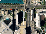 Digital Image Files Aerolist has access to a nationwide archive of high resolution georeferenced aerial imagery and can deliver in multiple file formats (TIFF, ECW, JPEG, MrSID, etc...) and projections to meet any customer specifications. Files start at $199. 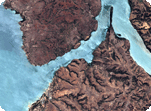 Satellite Imagery Aerolist is a reseller for DigitalGlobe and offers satellite imagery from QuickBird, WorldView-1 and WorldView-2. Customers can order from the massive archive or task one of the satellites for a new collect of their exact AOI. 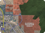 Rolled Products Rolled Products offer the same aerial scope and critical information that our Wall Murals do, but in a convenient roll-able poster that provides a marketing tool the customer can take with them. Custom posters with your logo and information are also available.
| |||||